US satellite imagery restrictions leave journalists in the dark on Iran and Gaza

As the US and Israel launched joint strikes on Iran on 28 February and Tehran retaliated on targets across the Gulf, a quieter contest was taking shape over who could access satellite imagery of the war.
One week after the initial strikes, US firm Planet Labs, the leading satellite imagery provider, announced it would release Gulf imagery with a four-day delay.
Within days, the delay had been extended to 14 days and expanded to most of the Middle East. By early April, following a request from the US government, Planet Labs had made the restriction on high-quality imagery of the region indefinite.
The most recent commercially available images of the Gulf now date from 9 March. Planet Labs said the decision was made in consultation with the government and external experts.
But many open-source journalists and analysts are worried this is beginning to resemble censorship.
New MEE newsletter: Jerusalem Dispatch
Sign up to get the latest insights and analysis on Israel-Palestine, alongside Turkey Unpacked and other MEE newsletters
Bill Greer, co-founder of Common Space, a nonprofit satellite initiative, told Middle East Eye: “It has become increasingly clear that access to satellite imagery is gradually disappearing from public view.”
The stated justification is that, in the wrong hands, the imagery could be used to target US troops or allied infrastructure in the Gulf.
However, experts in the industry told MEE that while a two-week delay addressed this hypothetical risk, they could not see a comparable justification for the indefinite freeze.
On 1 July, Planet Labs lifted some restrictions, particularly over Iran, but most of the suspension over the Gulf remains in place.
'Reduction in transparency'
Journalists and analysts also question the logic behind the restrictions, as many of the foreign powers the US considers hostile already operate their own satellite networks.
Tom Brown, an open-source investigative reporter, told MEE he was “highly sceptical of the claim that the US or Israel is deterring any adversaries by censoring satellite providers”.
For instance, leaked documents from Iran’s Revolutionary Guard suggest Tehran relies on Chinese satellite imagery for military intelligence. Iran operates its own Earth Observation satellites, launched by Russian Soyuz rockets.
'The restrictions on US satellites are more about avoiding embarrassment or accountability than anything else'
- Tom Brown, investigative reporter
A Columbia Journalism Review investigation found “no evidence that Iranian forces have, in fact, used imagery from any US satellite vendor”, adding it was “unclear” why Iran would need to, “since Tehran has its own sources of satellite data”.
“The restrictions on US satellites are more about avoiding embarrassment or accountability than anything else,” Brown said.
Jake Godin, a senior researcher at Bellingcat, the open-source investigative group, agreed, telling MEE the restrictions “are just making it harder for news outlets and NGOs to assess and verify damage”.
He said this was posing problems for “the information environment in general” and creating “fertile ground for the spread of misinformation”.
The consequence, Greer said, is a “reduction in the transparency of events that impact the public at a literal global scale”.
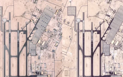
“As satellite imagery is restricted, it is also becoming more politicised,” he added.
Greer warned in particular about imagery that remains accessible but selectively released: the images stay “accurate, but will not show the entire story”.
That shift, he said, is “accelerating both through financial and regulatory means”.
Regulatory, because the US government can restrict satellite imagery providers directly, and financial, because it is also their largest customer, giving companies like Planet Labs a commercial incentive to comply even without formal pressure.
“Many of these companies are publicly traded, putting pressure on them to grow at any cost,” Greer added. Planet Lab’s stock has been volatile since the war began, down 15 percent over the past six months.
The paradox is that the quantity of imagery is growing even as access to it shrinks.
As many as 60 countries now have functional Earth Observation satellites or active construction programmes, from Argentina to Canada, Turkey to India, alongside commercial operators such as China's and Airbus.
“The amount of imagery created is not indicative of the access to that data,” Greer noted.
Contradicting official narratives
Satellite imagery is a critical tool for journalists, humanitarian groups and open-source analysts monitoring conflicts worldwide, and it is often the clearest way to contradict misleading or incomplete government narratives.
The most recent case is the bombing of a school in Minab, Iran, by the US military which killed 156 civilians, including 120 schoolchildren, and which Unesco called “a grave violation of humanitarian law”.
The US initially denied responsibility, but the New York Times found a US Tomahawk missile had most likely caused the explosion, and used satellite images to confirm the location.
The Pentagon said last month its investigation was still ongoing.

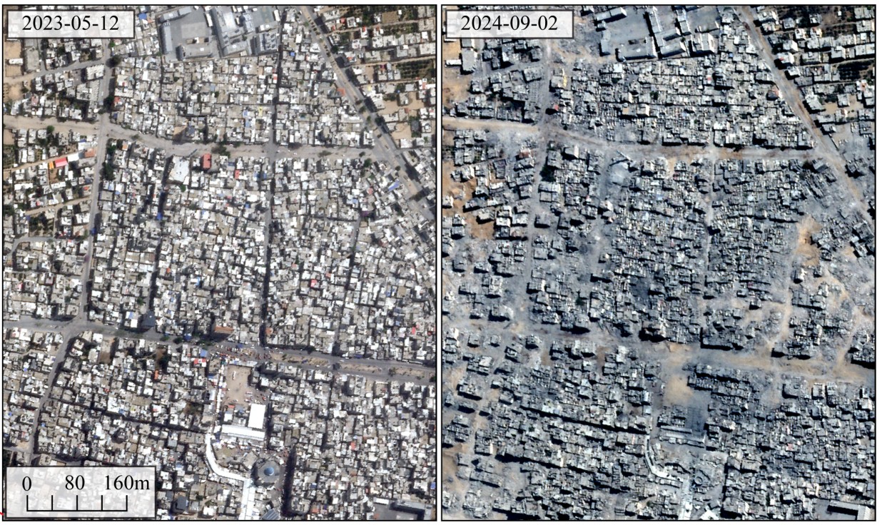
Satellite images have also been used to show the scale of Israel’s destruction in Gaza.
An Oregon State University study using the European Sentinel-1 network found that over three-fifths of all buildings in the Palestinian enclave were damaged or destroyed in the first year of the war, a proportion comparable to the 54 percent of buildings destroyed in Dresden by Allied bombing in the Second World War.
CNN used satellite imagery to identify where six US personnel were killed in an Iranian strike on Kuwait in March, before the US government disclosed any details, while the New York Times used it to assess damage to US military sites across the Gulf.
Satellite imagery was also used to confirm Israel’s responsibility in the killing of Reuters journalist Issam Abdallah in southern Lebanon in 2023.
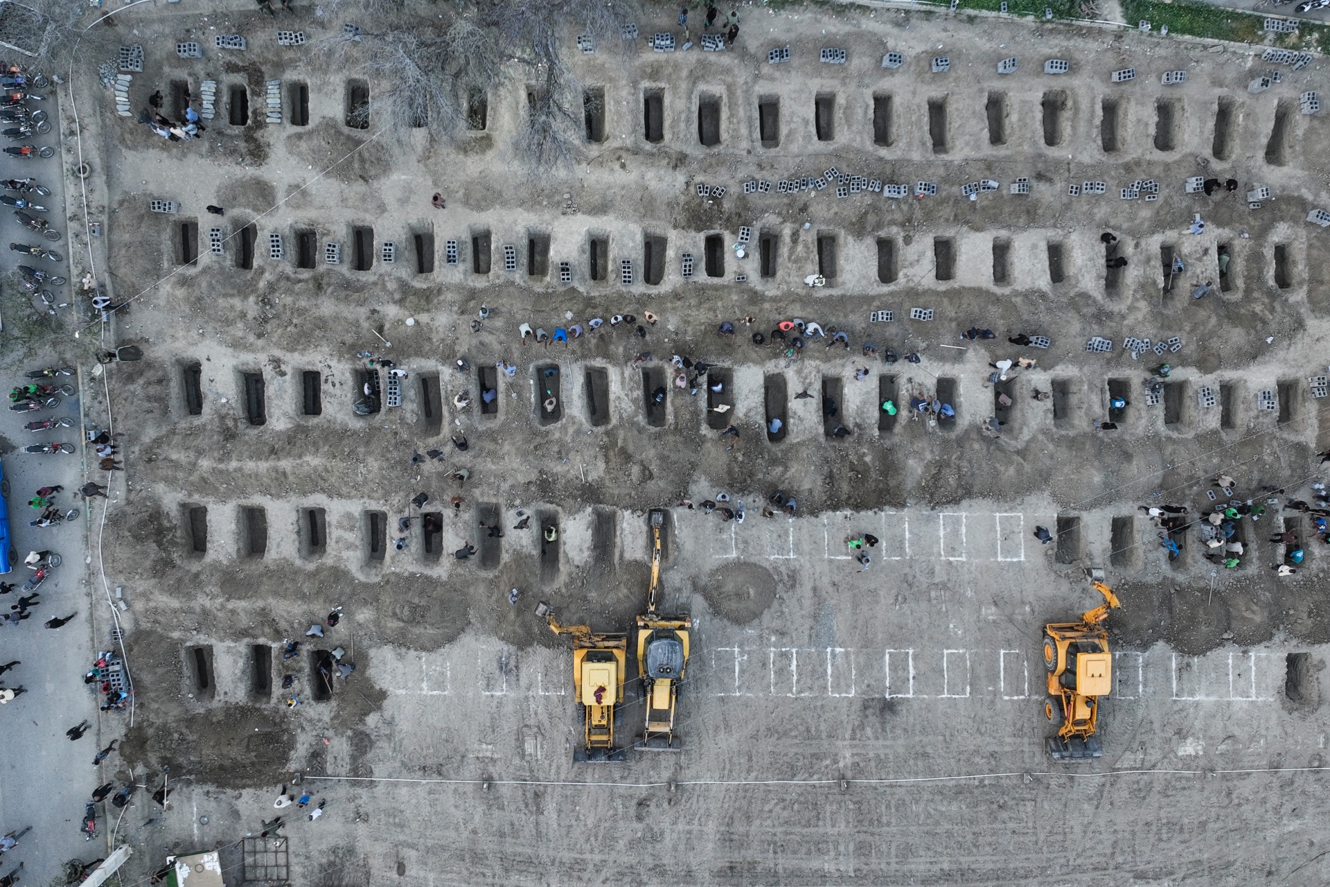
Without reliable access to this imagery, journalists warn, gathering evidence to challenge official accounts will only get harder.
“Without safeguards, warzones risk going dark,” Open-Source Intelligence (Osint) analyst Alex Shaw told Middle East Eye.
Turn to China and Europe
To get around US restrictions, journalists and analysts MEE spoke to are increasingly turning to European and Chinese providers instead.
Babak Taghvaee, a defence and Osint journalist, said he repeatedly hit restrictions “while attempting to purchase imagery of locations inside Iran” and turned instead to commercially available Chinese satellite imagery.
While this is a viable alternative, he said, it is “more expensive than comparable products” from the US.
The European Space Agency (ESA) is another option. Its Sentinel-1 satellite has “become the workhorse for conflict damage mapping in the region in recent years”, Shaw said.
'A public scientific mission, funded by the EU, is delaying imagery release due to US pressures'
- Bill Greer, co-founder of Common Space
But even the ESA’s service is not immune to US pressure. Since 13 July the ESA has released its imagery of parts of the Middle East, including Hormuz, with a 24 hour delay.
The move was made following a formal request by US officials to EU foreign policy chief Kaja Kallas.
Greer said he was “a little confused, and highly concerned” by the move. “A public scientific mission, funded by the EU, is delaying imagery release due to US pressures,” he told MEE.
Godin said for Bellingcat, “Sentinel-2 continues to be a valuable resource for getting around satellite restrictions”, but its lower resolution often is insufficient to identify which specific buildings have been damaged or destroyed.
This makes it harder, he said, to verify damage to infrastructure like water systems in southern Lebanon “if there are no available photos or videos showing a site suspected of being damaged”.
Brown said the restrictions make journalists’ and fact-checkers’ work more difficult without deterring it altogether, pointing to a growing utilisation of user-generated content, such as videos posted directly to social media.
Controlling conflict visibility
Satellite imagery is often one of the only ways for journalists to assess situations in hard-to-reach or dangerous areas.
“Conflict visibility depends not only on events on the ground but also on who controls access to satellite imagery,” Shaw said. He noted high-resolution images are “commonly shared for free after natural disasters but not for conflicts, which limits scientific and humanitarian access”.
'There’s a very real danger journalists and researchers will be blindfolded'
- Alex Shaw, open-source analyst
In Gaza for example, Israel has banned all foreign journalists from entering the strip since 2023, leaving newsrooms reliant on satellite imagery and local reporters.
Godin said the most recent restrictions “have made continued monitoring and verification of damage and destruction in places like Gaza or southern Lebanon more difficult”.
Where ground access is dangerous or impossible, Shaw said, journalists and researchers depend on satellite “eyes from above”, and “there's a very real danger they will be blindfolded”.
Bias in the selection of satellite coverage of conflicts also leads to uneven visibility. Shaw said “commercial providers often have uneven archive coverage that leaves some conflicts poorly represented”, citing the example of Sudan.
Israel's special situation
Since 1997, US legislation has required American satellite imagery providers to keep the resolution of Israel imagery below a certain threshold. Israel is the only country to receive this kind of protection by law.
The difference is visible even on public tools such as Google Earth, where Israeli imagery has deliberately been blurred.
Comparing intersections in Tel Aviv and foreign cities makes it obvious. In Tel Aviv, car edges are blurred and crosswalk stripes indistinguishable, while in Ankara, for example, both are sharp and clear.
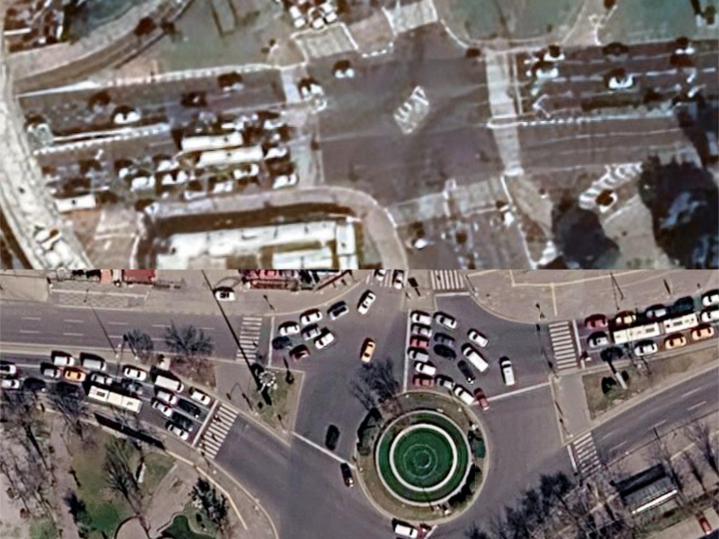
This has concerned journalists and humanitarians for decades, as it has complicated not only the monitoring of Israel’s genocide in Gaza, but also the growth of its illegal settlements in the West Bank, where satellite imagery would easily reveal the construction of new buildings.
Since 1992, US-based satellite imagery providers have needed a government licence to operate, which grants the US “shutter control” - the ability to restrict image releases.
That power was never formally invoked, though the Pentagon bought up all available satellite imagery of Afghanistan in 2001 to keep it out of public circulation.
'Worrying precedent'
Commercial incentives and regulatory pressure have been pulling satellite imagery providers away from journalists, humanitarian organisations and other civilian customers.
Greer said this trend is not new, but “the shift towards defence contracts has dramatically increased in the past 18 months”.
Common Space, the non-profit that Greer co-founded as an alternative to commercial providers, aims to “increas[e] independent access to imagery as a tool for transparency”, built specifically for humanitarian groups, journalists and academics.
'Access to the information is being limited for political reasons, in support of an unpopular war'
- Bill Greer, co-founder of Common Space
The broader problem, he added, is political: “The public's access to the information to make informed decisions is being limited for political reasons, in support of an unpopular war.”
Experts who rely on satellite imagery remain worried about the future.
“My biggest concern right now is that we will see further restrictions, and those restrictions will be codified into law and regulatory frameworks taking imagery access permanently out of the hands of the people that need it most to improve the lives of others,” Greer said.
Shaw agreed, warning that the “recent restrictions set a worrying precedent for how accessible imagery will be” going forward.
He said more “blind spots are likely to emerge in US commercial imagery”, pointing to the proposed 2027 Intelligence Authorisation Act, which would bar US government-contracted providers from publicly releasing “sensitive imagery that could harm national security”, a definition broad enough to be open to misuse.
Middle East Eye delivers independent and unrivalled coverage and analysis of the Middle East, North Africa and beyond. To learn more about republishing this content and the associated fees, please fill out this form. More about MEE can be found here.